18 November 2026, The Brave India: Cyclone Akvan is strengthening over the Bay of Bengal and heading for India’s east coast — if you live in coastal Andhra Pradesh, Odisha or north Tamil Nadu, the next 48 hours matter. This update gives you its position, the IMD landfall forecast for Friday, 20 November, the red-alert districts, expected rain and wind, state preparations, and safety steps. The forecast changed during 18 November, so both the morning forecast and the afternoon revision are explained.
Cyclone Akvan: Where It Is Now
On Wednesday morning, 18 November 2026, Akvan had become a severe cyclonic storm over the central south and adjoining west-central Bay of Bengal. At 5.30 am, the IMD placed it about 610 km southeast of Machilipatnam, 610 km south-southeast of Visakhapatnam and 580 km east of Chennai, moving north-northwestwards at about 3 kmph, rising to 7 kmph by 8.30 am near 12.9°N, 85.4°E.
By the afternoon it lay about 540 km southeast of Narsapur, 690 km south of Gopalpur and 750 km south of Puri, moving at about 8 kmph. Akvan is the third cyclone to threaten the Andhra Pradesh coast in about three weeks, a pattern the IMD calls rare.
IMD Forecast: Landfall on 20 November
Morning forecast: Nellore to Visakhapatnam
The morning IMD bulletin forecast landfall between Nellore and Visakhapatnam around noon on Friday, 20 November 2026, as a severe cyclonic storm, with sustained winds of 100–110 kmph gusting to 120 kmph. Its coastal warning put winds at 120–130 kmph, gusting to 145 kmph, from the night of 19 November until landfall. Earlier bulletins said Akvan could become a very severe cyclonic storm by the evening of Thursday, 19 November.
Afternoon revision: Narsapur to Puri
Later on 18 November, the IMD revised the track northwards: landfall between Narsapur in Andhra Pradesh and Puri in Odisha by noon on 20 November, as a severe cyclonic storm with winds of 90–100 kmph gusting to 110 kmph. IMD chief Mrutyunjay Mohapatra said it could touch shore between Kalingapatanam and Gopalpur. The landfall day — Friday, 20 November, around noon — has not changed.
Which Districts Are on Alert
Seven Andhra Pradesh districts are under a red alert for heavy rain on 19 November: Kakinada, Konaseema, East Godavari, West Godavari, Eluru, Krishna and Bapatla. Yanam is also included. The IMD has issued a cyclone alert (orange message) for Andhra Pradesh and adjoining south Odisha coasts.
In Odisha, a red warning of extremely heavy rain covers Kendrapara, Jagatsinghpur, Puri, Ganjam, Gajapati and Kandhamal on 19 November, and Mayurbhanj and Baleshwar on 20 November. Ganjam, Gajapati, Rayagada, Kandhamal, Malkangiri and Koraput are highly vulnerable to landslides. Follow your district administration first.
Rain, Wind and Storm Surge
Coastal Andhra Pradesh gets light to moderate rain at many places on 18 November. On 19 and 20 November, expect heavy to very heavy rain, with isolated extremely heavy rain of 21 cm or more over coastal Andhra Pradesh and south Odisha, plus heavy rain over north Odisha and Rayalaseema. Rain should ease on 21 November; the IMD warns of flooding, waterlogging and landslides.
The morning forecast warned of a surge of 0.4–1.2 metres inundating low-lying areas of Prakasam, Bapatla, Krishna, West Godavari, Konaseema, Kakinada and Visakhapatnam; the afternoon revision put it at 0.5–1 metre in those districts plus Vizianagaram, Srikakulam, Ganjam, Khordha and Puri. Stay away from the coast on 19 and 20 November.


Preparations on the Ground
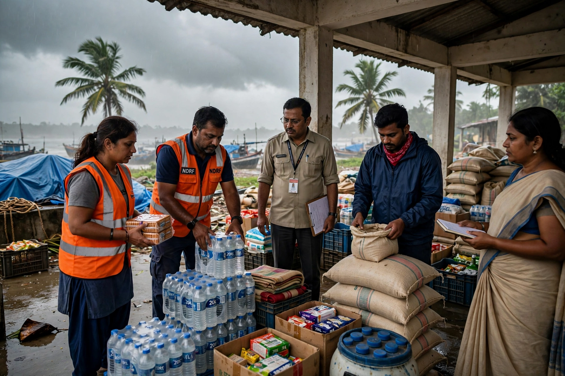
Andhra Pradesh Deputy Chief Minister Pawan Kalyan has told red-alert district administrations to stay vigilant, identify people in vulnerable coastal and low-lying areas, shift them to safety where needed, and keep relief camps stocked with food and drinking water. Chief Minister N. Chandrababu Naidu directed precautionary measures on Monday.
Odisha has deployed 74 rescue teams and senior IAS officers, identified about 2,04,070 people for possible evacuation across eight districts and 3,329 cyclone shelters. Beach tourism is suspended, the Coast Guard is on maximum alert, Puri’s Gundicha Temple stays closed from 19 to 21 November, and Malkangiri schools are closed on 19 and 20 November.
Trains, Flights and Travel
No confirmed list of cancelled trains or flights had been verified from official announcements, so none is published here. Check with the Railways, your airline or the airport before travelling on 19 and 20 November, and avoid non-essential travel to red-alert districts. Fishermen should stay off the west-central Bay of Bengal until the morning of 21 November.
Also Read: Delhi AQI Today, 18 November 2026: AQI 200 (Moderate), Uttam Nagar Worst at 399
Cyclone Safety: Do’s and Don’ts
Stay indoors in strong winds and heavy rain, and move to a cyclone shelter or strong building if officials ask you to evacuate. Store water, dry food, medicines and a torch, keep your phone charged, and follow IMD alerts. In an emergency, call 112.
Do not visit beaches or low-lying coastal areas to watch the sea, or fish or boat until the IMD clears the sea. Do not shelter under trees or near loose poles in high winds, touch fallen power lines, or drive through waterlogged roads. Do not trust unverified cyclone videos online.
Conclusion
Landfall is expected around noon on Friday, 20 November, heavy to extremely heavy rain is forecast for 19 and 20 November, and seven Andhra districts and several Odisha districts are on red alert. The forecast shifted during the day, so follow the latest IMD bulletin and your district administration. Prepare today, stay away from the coast, and check on elderly neighbours in vulnerable areas.
Read more
Delhi AQI Today, 18 November 2026: AQI 200 (Moderate), Uttam Nagar Worst at 399 ›
Mumbai Birth Certificate in 3 Days: BMC Hospitals to Issue Certificates at the Hospital Itself, No Ward Office Visit Needed ›
Odisha DA Hike: Dearness Allowance Raised by 3% to 63% from 1 July 2026, 8.5 Lakh Employees and Pensioners to Benefit ›
Frequently Asked Questions
When will Cyclone Akvan make landfall?
Around noon on Friday, 20 November 2026 — between Nellore and Visakhapatnam in the morning forecast, revised in the afternoon to between Narsapur and Puri. Follow the latest IMD bulletin.
How strong will Cyclone Akvan be at landfall?
Morning forecast: a severe cyclonic storm at 100–110 kmph, gusting to 120 kmph, coastal gusts up to 145 kmph. Afternoon revision: 90–100 kmph, gusting to 110 kmph. Earlier bulletins said it could become a very severe cyclonic storm by the evening of 19 November.
Which districts are under red alert for Cyclone Akvan?
Andhra Pradesh: Kakinada, Konaseema, East Godavari, West Godavari, Eluru, Krishna and Bapatla on 19 November. Odisha: Kendrapara, Jagatsinghpur, Puri, Ganjam, Gajapati and Kandhamal, red warning for extremely heavy rain on 19 November.
What should people in coastal Andhra Pradesh do now?
Follow your district administration, move to a shelter if asked, stay away from beaches and low-lying areas on 19 and 20 November, stock water, food and medicines, and call 112 in an emergency. Fishermen should stay off the sea until the morning of 21 November.


Ayush Choudhary is the Founder & Editor-in-Chief of The Brave India, where he covers India news, state news, local news and government updates. He leads the newsroom’s reporting on markets, technology, sports and public policy, with a focus on accurate, timely stories for readers across the country.